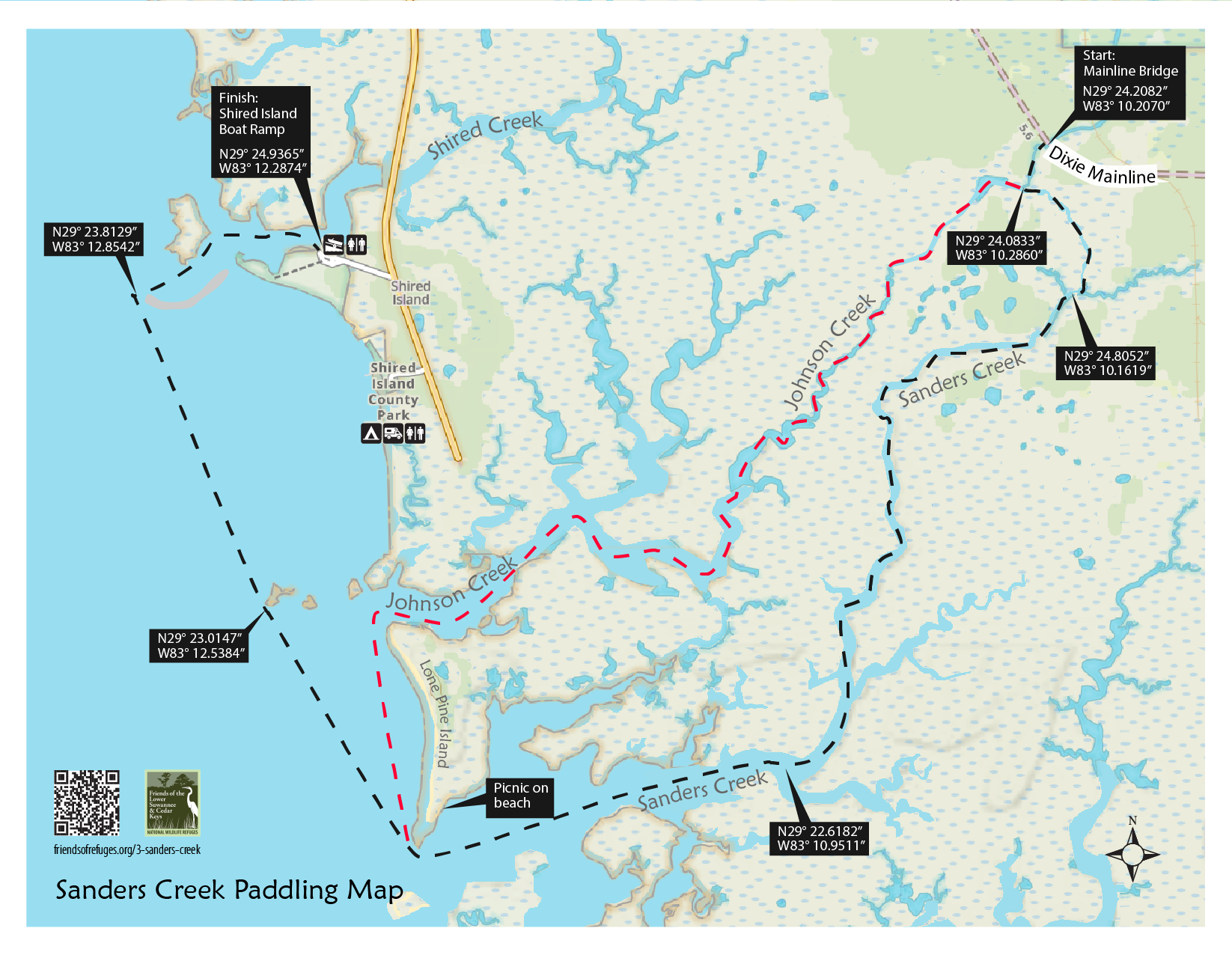
Paddle from maritime hammock, thru salt marsh and tidal estuary into Gulf of Mexico. Traveling the Dixie Mainline highway, an old railroad bed originally built for logging, one passes through cypress and hardwood swamps before reaching Sanders Creek. The primary paddling route follows the creek to its mouth and across the open waters of the Gulf of Mexico to the boat ramp at Shired Island. If only one vehicle is available, options allow one to return directly to the launch site. Two idyllic islands with sandy beaches are found near the mouth of the creek.
Sanders Creek is the most complex (natural communities) and challenging (navigational and paddling skills) trail in the Refuges. However, saltwater paddling venues with sandy beaches on Big and Little Pine Islands offer picnic, fishing, photographing and birding opportunities not collectively found on any other individual trail.
Length: 6.4 miles one way from the Dixie Mainline bridge, along tidal creek, thru salt marsh to the Gulf, then north along Big Pine Island to the mouth of Shired Creek, then along the creek to the Shired Island ramp. Alternate route (orange) instead of open gulf is to paddle up Johnson Creek back to Sanders Creek bridge (approx. 2.5 miles).
Time: 3.5 hours
Skill Level: Expert paddlers will enjoy this adventure. Beginners should not test their skills on this trail. Winds 10-15 mph can create waves 2-3 ft., requiring expert paddling skills and endurance to safely navigate the open water segments of this trail.
Directions to Launch Site: From US 19 in Cross City, take CR 351 south (towards Horshoe Beach) approximately 7.9 miles to intersection of CR 357 (look for signs to Shired Island). Turn left adn go south on CR 357 approximately 7.6 miles to the limerock Dixie Mainline Road. Turn left on the Dixie Mainline and continue to the third bridge. Launch at the SE side of the bridge.
CAUTIONS: If winds exceed 10 mph, paddlers not having expert skills should consider stopping at waypoint SAN05 and returning to launch site via Sanders Creek. Plan this trip around high tides because of numerous, shallow oyster bars at the mouth of Sanders and Johnson Creeks. This paddle is not safe in winds that exceed 15 mph.
BIOZONE 1. THE MARITIME HAMMOCK
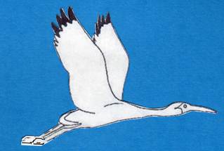
The maritime hammock is surrounded by swamp and occasional sandy uplands on both sides of the creek. Slightly lower, the creek bottoms support marsh punctuated by cabbage palms. The water in the creek is tidal and brackish. At this point, about four miles from the Gulf, smooth cordgrass (a plant of the salt marsh), black needlerush (a plant of brackish marshes), and sawgrass (characteristic of fresh marshes) are found growing close to one another, separated by slight differences in elevation. Blue crabs are abundant in the clear waters of the creek and white pelicans—seasonal residents—may be seen flying overhead.
BIOZONE 2. THE LOWER CREEK
Proceeding down toward the Gulf, the creek gradually widens, and hammocks are seen at ever increasing distances from the paddler. At times only vast areas of marsh are visible, whereas at others distant hammocks appear on the horizon. More sheltered than waters facing the open Gulf, these areas are hospitable for many marine and estuary creatures. Although wildlife are not conspicuous, the shallow waters of the lower creek are important because their shoals provide places of attachment for oysters and other invertebrate animals, shelter for other small animals, and foraging places for predatory fishes.
BIOZONE 3. BIG PINE ISLAND AND THE BEACH
Relatively rare in Suwannee Sound, sandy beaches are vitally important habitats for animals such as horseshoe crabs and diamondback terrapins, each of which relies on beaches to lay their eggs. The abundant eggs of horseshoe crabs are important food for certain shorebirds. The eggs of terrapins may be eaten by raccoons, wild hogs, and other mammals, and islands may be especially important if they are inaccessible to these predators. The interior of Big Pine Island has a few pines and palms, and is dominated by oaks and Red cedars.
SPYGLASS: THE EDGE OF THE GULF
The open Gulf is much more subject to wind and resultant wave action than are sheltered creeks and bays. Waves erode the shoreline, creating a narrow beach, where shifting sands prevent the establishment of plant life. This is a “low energy coastline,” and its beaches are less extensive than on the high energy Atlantic Coast. The Gulf here is shallow and has hard bottom areas that are relatively stable and suitable for the establishment of oyster beds. Although sometimes difficult for paddlers, shallow hard bottom areas are important for marine life. Both attached and burrowing animals and patches of smooth cordgrass colonize them, and they provide the basis for a food chain that ultimately supports large fishes, predatory birds, and bottlenose dolphins.


Friends of the Lower Suwannee & Cedar Keys National Wildlife Refuges
P. O. Box 532 Cedar Key, FL 32625 friends@friendsofrefuges.org We are a 501(c)(3) nonprofit organization. |
|