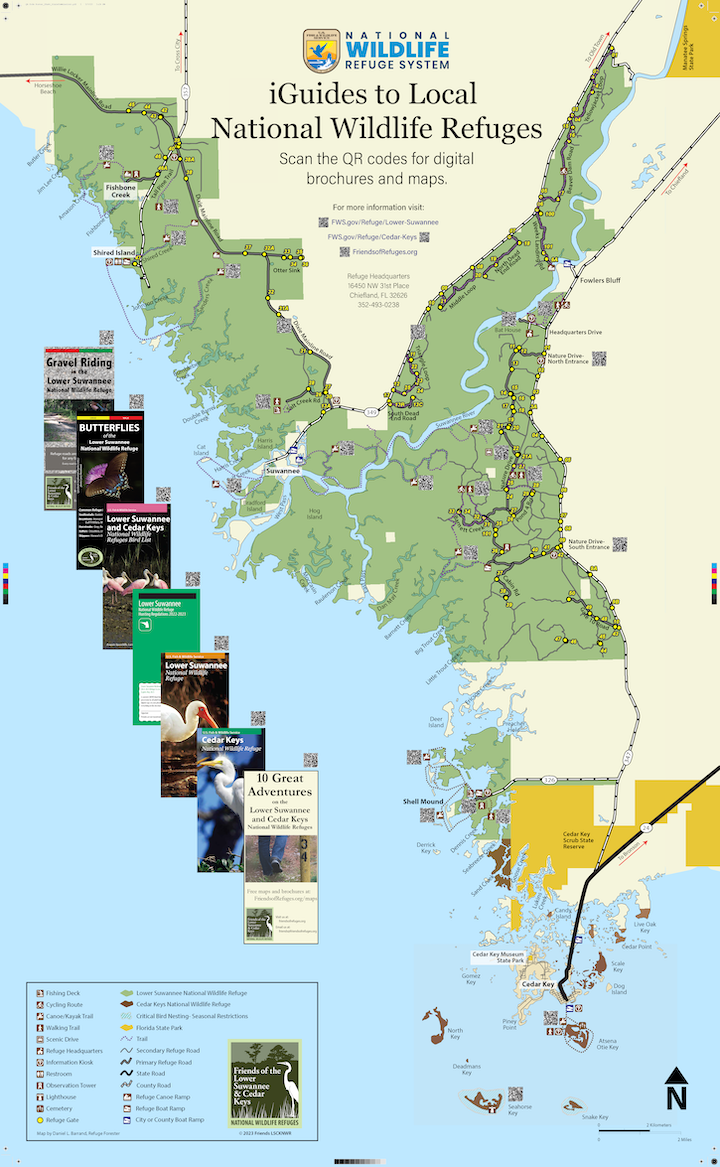
Maps & Trails |
MapsOVERVIEW MAPS GEOSPATIAL MAPS Import these into the Avenza app for offline use on your mobile phone. Instructions |
General Guides
The Refuge us open sunrise to sunset. Ticks and winged biting insects can be abundant. Pets are allowed on a leash. |
All refuge maps were produced by Daniel L. Barrand, Refuge Forester.
Trail Guides (listed north to south)
|
Behind the gates you sometimes find the best hiking, cycling, and wildlife observation. You are welcome to explore the Refuge's 194 miles of former logging roads, but please do not block the gates with your car in case a refuge vehicle or equipment needs access. Most secondary roads are mowed regularly.
Bikes and E-bikes are permitted. During hunting season, non-hunters are free to access the Refuge and can do so safely by following these basic guidelines from Andrew Gude, Refuge manager:
|
Most Refuge kiosks have posters like this with QR codes leading to detailed maps and information.
|
10 Great Adventures
|
hike/drive/paddle
|
various lengths
|
Favorite activities on our Refuges.
|
Gravel Riding (off-road biking)
|
bike
|
various lengths
|
Recommended rides chosen from nearly 200 miles of former logging roads available.
|
Dixie Mainline Guide by U.S. Fish & Wildlife Service
|
hike/drive/bike
|
9 miles
|
Activities and points of interest along the Dixie Mainline.
|
Dixie Mainline Hiking Trails
|
hike/drive/bike
|
8.5 miles
|
Hiking trails, history and habitats along the Dixie Mainline.
|
CR 349 Refuge Cycling Tour
|
bike
|
14.5 miles
|
Five primary but seldom traveled Refuge roads off CR 349 in Dixie County.
|
River Walk and Tram Ridge Trails
|
hike
|
River Walk-1 mile
Tram Ridge- 2.8 mile loop
|
In 2023, Hurricane Idalia destroyed the River Walk boardwalk. The trail is now closed.
The Tram Ridge Trail is still open, giving access to bottomland hardwood forest, scrubby flatwoods, and cypress ponds, |
Nature Drive Guide
|
hike/drive/bike
|
9 miles one-way
|
This beautiful primary refuge road is the gateway to many refuge adventures.
|
Gate 3 and 15 in Levy
|
hike/bike
|
1.2 miles RT
|
Easy walk through nice pine flatwood habitat. Cross the road and continue on the Gate 14 trail (see below).
|
Gate 11 in Levy
|
hike/bike
|
1.3 miles RT
|
Although the trail goes near the Refuge Headquarters, access to the headquarters is not allowed from this trail.
|
Gate 12 in Levy
|
hike/bike
|
1.6 miles RT
|
There is a spur to the left .12 miles from Gate 12 with a round trip of 1.4 miles. This spur goes through similar habitats with University of Florida insect study facilities near its end.
|
Gate 14 in Levy
|
hike/bike
|
1.2 miles RT
|
Easy walk through longleaf pine habitat merging into riverine floodplain and then ending at expansive view of Suwannee River. Take camp chairs and enjoy the view on the small beach.
|
Gate 21 in Levy
|
hike/bike
|
.8 miles RT
|
Easy, but often soggy, walk through riverine floodplain ending at edge of scenic Sandfly Creek.
|
Turkey Foot Loop Trail- Gates 23, 24, 28
|
hike/bike
|
2.17 mile loop
|
One of the best trails for seeing birds and butterflies, especially during spring.
|
Barnett Creek Loop Trail- Gates 31, 34
|
hike/bike
|
2.8 mile loop
|
This secondary road loop traverses some of our best land and water scenery.
|
Dennis Creek Trail
|
hike/bike
|
1 mile
|
Nearly all the Gulf of Mexico coastal ecological features are visible from land on this trail.
|
Shell Mound Trail
|
hike
|
.5 miles
|
Fascinating archaeological trail with interpretive panels.
|
Paddling and Fishing Guides
(listed north to south)
|
Refuge waters include approximately a dozen ponds ranging in size from less than 1 acre to several acres. Bank fishing is allowed, and boat ramps are available to access the Suwannee River and its tributaries or the Gulf of Mexico and its tidal creeks.
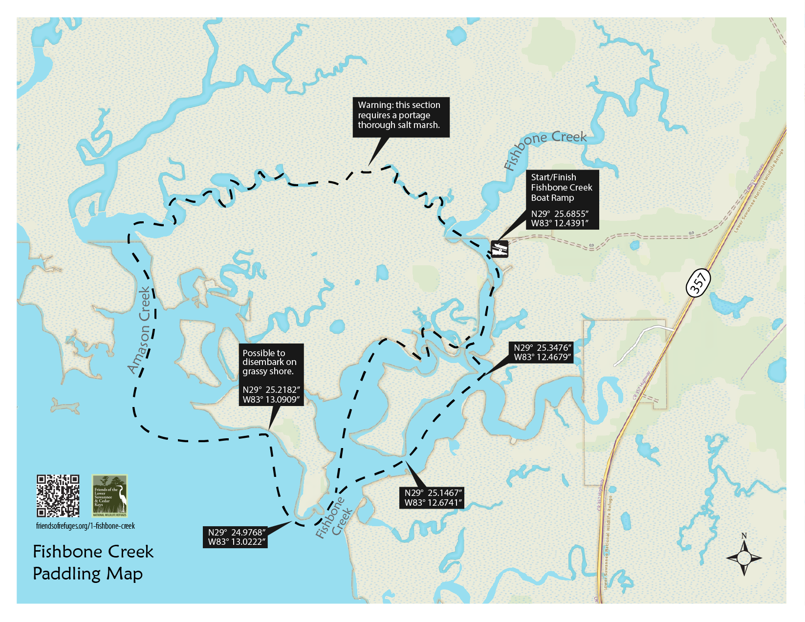
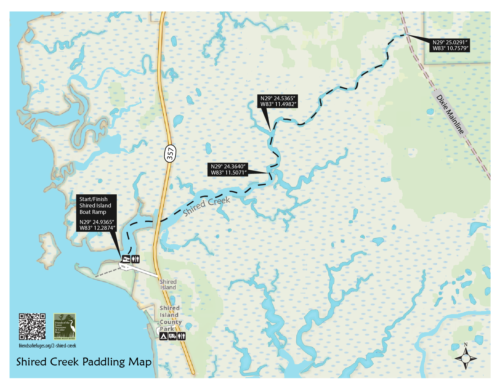
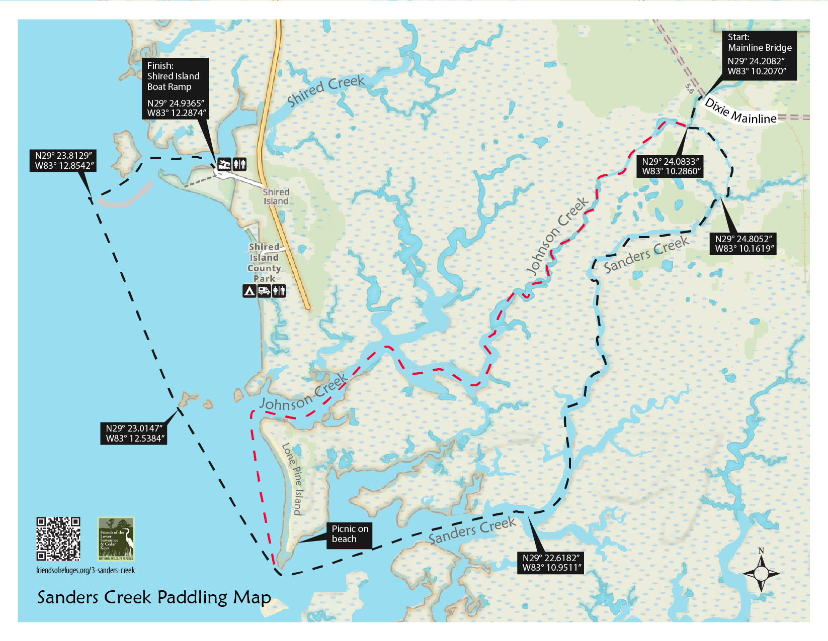
Some of the wonders of the Refuges are best explored by paddling. The paddling trails below are listed north to south. Click the links below for more information and downloads for each paddle. Downloadable 11" x 17" panels are free for your personal use. They are copyrighted by Friends and may not be sold or used for any commercial purpose without permission of Friends. |

|
Fishbone Creek
Shired Creek
Shired Island Fishing Guide
Sanders Creek
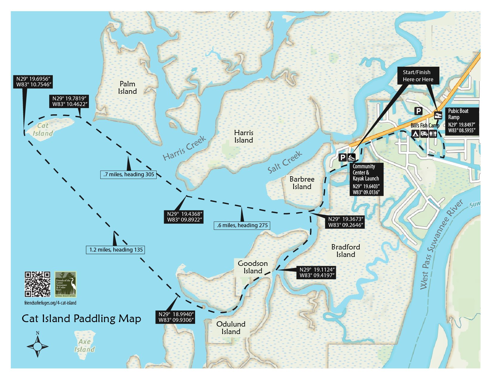
Cat Island
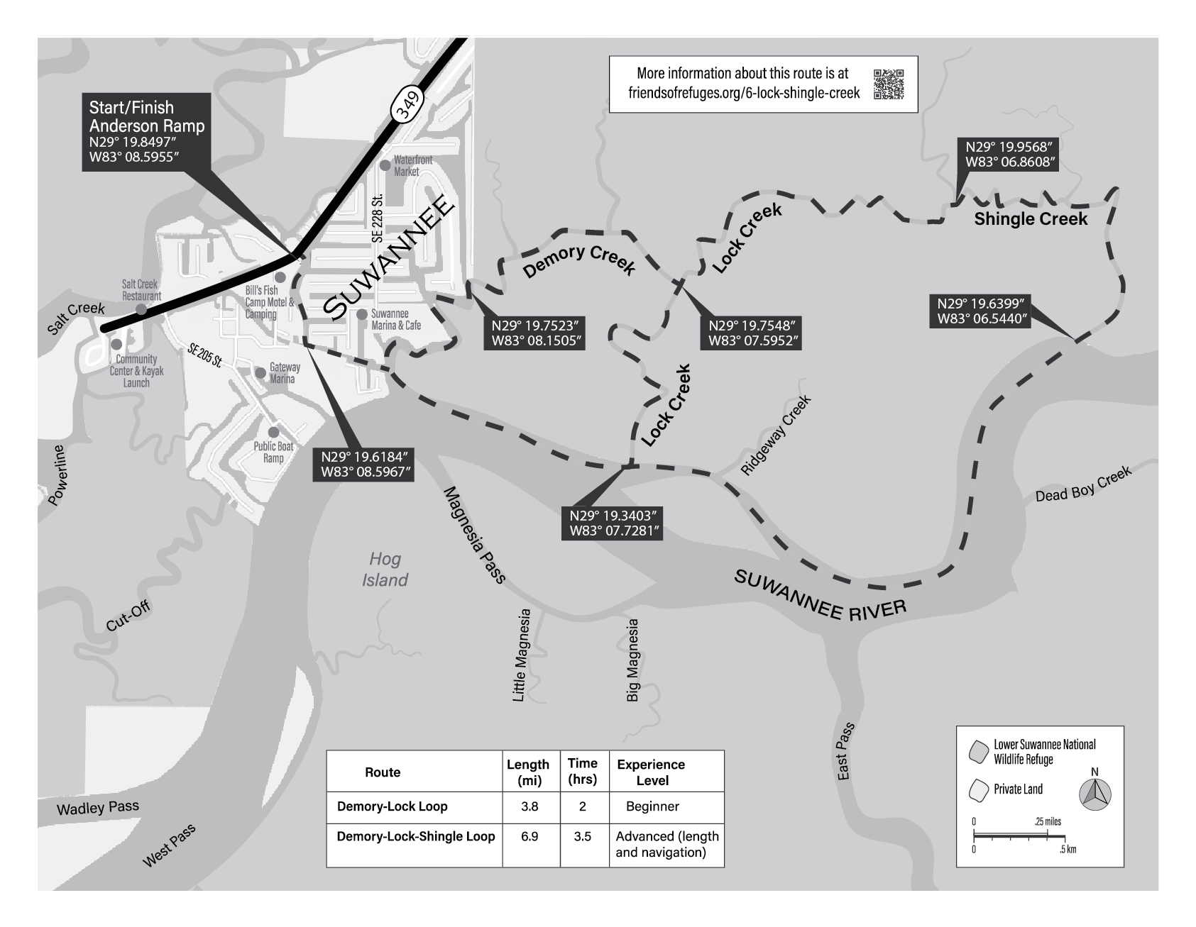
Demory/Lock/Shingle Creeks
Demory/Lock Creeks
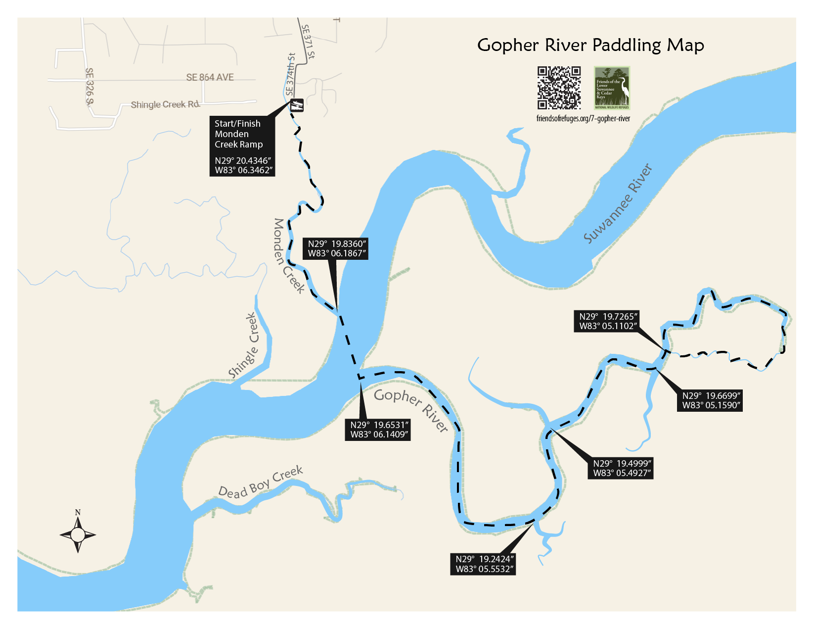
Gopher River
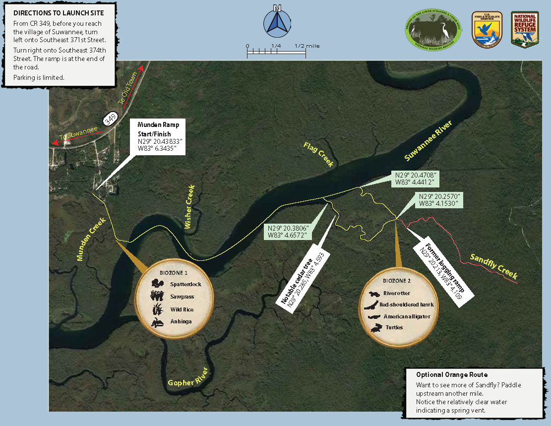
Sandfly Creek
Suwannee River Fishing Guide
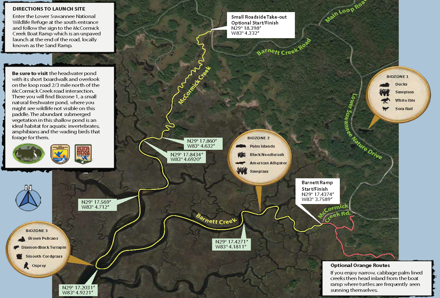
Barnett to McCormick Creek
Barnett to McCormick Fishing Guide
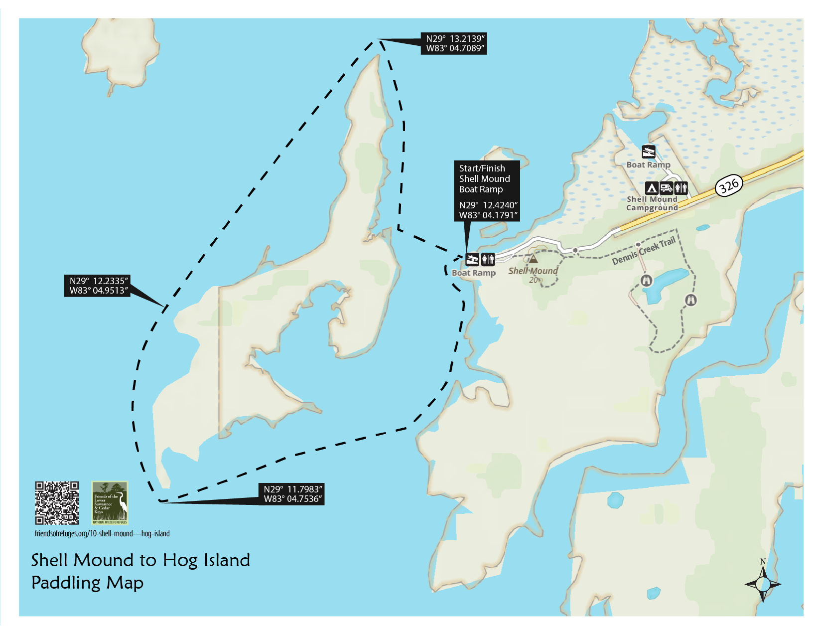
Shell Mound to Hog Island
Shell Mound Fishing Guide
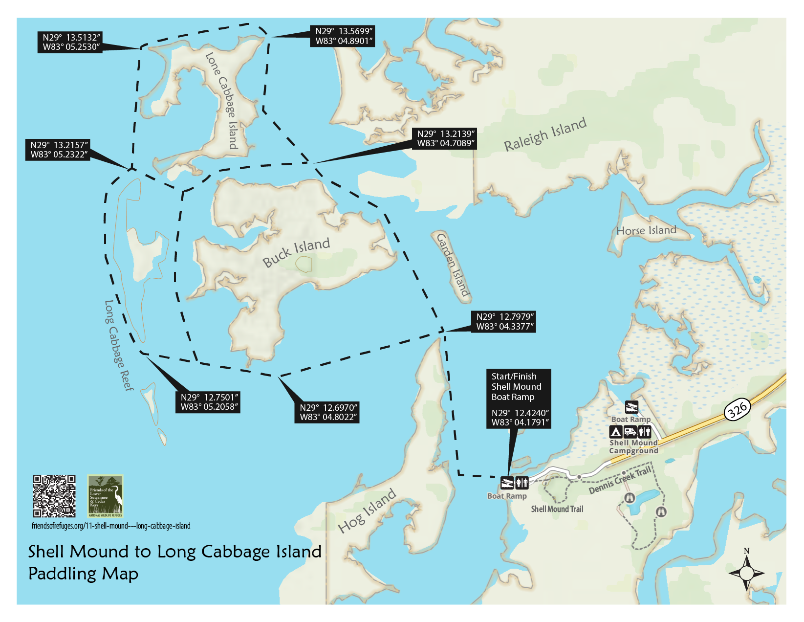
Shell Mound to Long Cabbage Island
Cedar Key to Atsena Otie
Atsena Otie Fishing Guide
Cedar Key Airport Fishing Guide
Friends of the Lower Suwannee & Cedar Keys National Wildlife Refuges
P. O. Box 532 Cedar Key, FL 32625 [email protected] We are a 501(c)(3) nonprofit organization. |
|