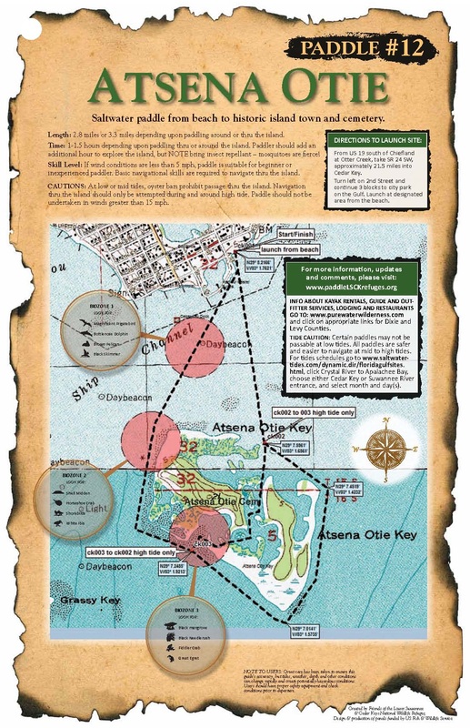
Atsena Otie Key |
A saltwater paddle to a historic island town and cemetery.
Length: 2.8 miles or 3.3 miles depending upon paddling around or through the island.
Time: 1-1.5 hours. Paddlers should add an additional hour to explore the island.
Skill Level: If wind conditions are less than 5mph, paddle is suitable for beginner or inexperienced paddler. Basic navigation skills are required to navigate through the island.
Directions to the Launch Site: Once you have entered Cedar Key on SR 24, turn left on 2nd Street and continue 3 blocks to the city park on the Gulf. Launch at designated area from the beach.
Notes: Bring insect repellent – mosquitoes are fierce! At low or mid tides, oyster bars prohibit passage through the island. Navigation should only be attempted during high tide. Paddle should not be undertaken in winds greater than 10 mph. Wear your PFD.
You may disembark and explore Atsena Otie Key, it is never closed due to shorebird nesting as many of the other islands in the Refuge are.
- Read about the rich history of Atsena Otie.
- More information about Atsena Otie and the Cedar Keys is in the Fish & Wildlife Service's Cedar Keys General Guide
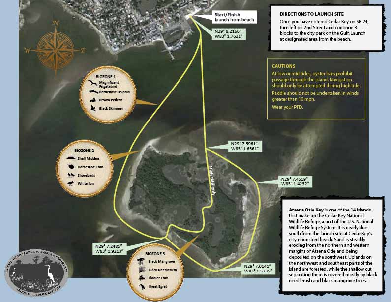
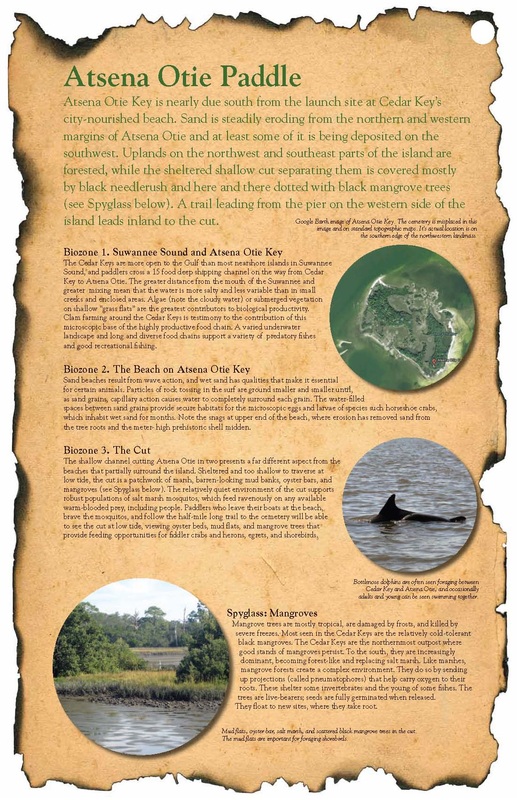
BIOZONE 1: SUWANNEE SOUND AND ATSENA OTIE KEY
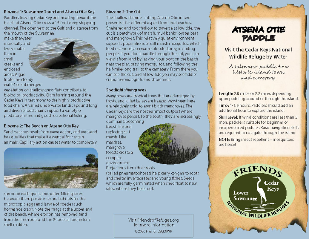
Paddlers leaving Cedar Key and heading toward the beach at Atsena Otie cross a 15-foot-deep shipping
channel. The openness to the Gulf and distance from the mouth of the Suwannee make the water more salty and less variable than in small creeks and enclosed areas. Algae (note the cloudy water) or submerged vegetation on shallow grass flats contribute to biological productivity. Clam farming around the Cedar Keys is testimony to the highly productive food chain. A varied underwater landscape and long and diverse food chains support a variety of predatory fishes and good recreational fishing.
BIOZONE 2: THE BEACH ON ATSENA OTIE KEY
Sand beaches result from wave action, and wet sand has qualities that make it essential for certain
animals. Capillary action causes water to completely surround each grain, and water-filled spaces between them provide secure habitats for the microscopic eggs and larvae of species such as horseshoe crabs. Note the snags at the upper end of the beach, where erosion has removed sand from the tree roots and the 3-foot tall prehistoric shell midden.
BIOZONE 3: THE CUT
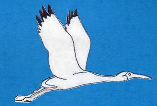
The shallow channel cutting Atsena Otie in two presents a far different aspect from the beaches. Sheltered and too shallow to traverse at low tide, the cut is a patchwork of marsh, mud banks, oyster bars and mangroves. This relatively quiet environment supports populations of salt marsh mosquitos, which feed ravenously on warm-blooded prey, including people. If you don’t paddle through the cut, you can view it from land by leaving your boat on the beach near the pier, braving mosquitos, and following the half-mile-long trail to the cemetery. From there you can see the cut, and at low tide you may see fiddler crabs, herons, egrets and shorebirds.
SPOTLIGHT: MANGROVES
Mangroves are tropical trees that are damaged by frosts, and killed by severe freezes. Most seen here are relatively cold-tolerant black mangroves. The Cedar Keys are the northernmost outpost where mangroves persist. To the south, they are increasingly dominant, becoming forest-like and replacing salt marsh. Like marshes, mangrove forests create a complex environment. Projections from their roots (called pneumatophores) help carry oxygen to roots and shelter invertebrates and young fishes. Seeds which are fully germinated when shed float to new sites, where they take root.
Paddlers leaving Cedar Key and heading toward the beach at Atsena Otie cross a 15-foot-deep shipping
channel. The openness to the Gulf and distance from the mouth of the Suwannee make the water more salty and less variable than in small creeks and enclosed areas. Algae (note the cloudy water) or submerged vegetation on shallow grass flats contribute to biological productivity. Clam farming around the Cedar Keys is testimony to the highly productive food chain. A varied underwater landscape and long and diverse food chains support a variety of predatory fishes and good recreational fishing.
BIOZONE 2: THE BEACH ON ATSENA OTIE KEY
Sand beaches result from wave action, and wet sand has qualities that make it essential for certain
animals. Capillary action causes water to completely surround each grain, and water-filled spaces between them provide secure habitats for the microscopic eggs and larvae of species such as horseshoe crabs. Note the snags at the upper end of the beach, where erosion has removed sand from the tree roots and the 3-foot tall prehistoric shell midden.
BIOZONE 3: THE CUT
The shallow channel cutting Atsena Otie in two presents a far different aspect from the beaches. Sheltered and too shallow to traverse at low tide, the cut is a patchwork of marsh, mud banks, oyster bars and mangroves. This relatively quiet environment supports populations of salt marsh mosquitos, which feed ravenously on warm-blooded prey, including people. If you don’t paddle through the cut, you can view it from land by leaving your boat on the beach near the pier, braving mosquitos, and following the half-mile-long trail to the cemetery. From there you can see the cut, and at low tide you may see fiddler crabs, herons, egrets and shorebirds.
SPOTLIGHT: MANGROVES
Mangroves are tropical trees that are damaged by frosts, and killed by severe freezes. Most seen here are relatively cold-tolerant black mangroves. The Cedar Keys are the northernmost outpost where mangroves persist. To the south, they are increasingly dominant, becoming forest-like and replacing salt marsh. Like marshes, mangrove forests create a complex environment. Projections from their roots (called pneumatophores) help carry oxygen to roots and shelter invertebrates and young fishes. Seeds which are fully germinated when shed float to new sites, where they take root.
Friends of the Lower Suwannee & Cedar Keys National Wildlife Refuges
P. O. Box 532 Cedar Key, FL 32625 [email protected] We are a 501(c)(3) nonprofit organization. |
|