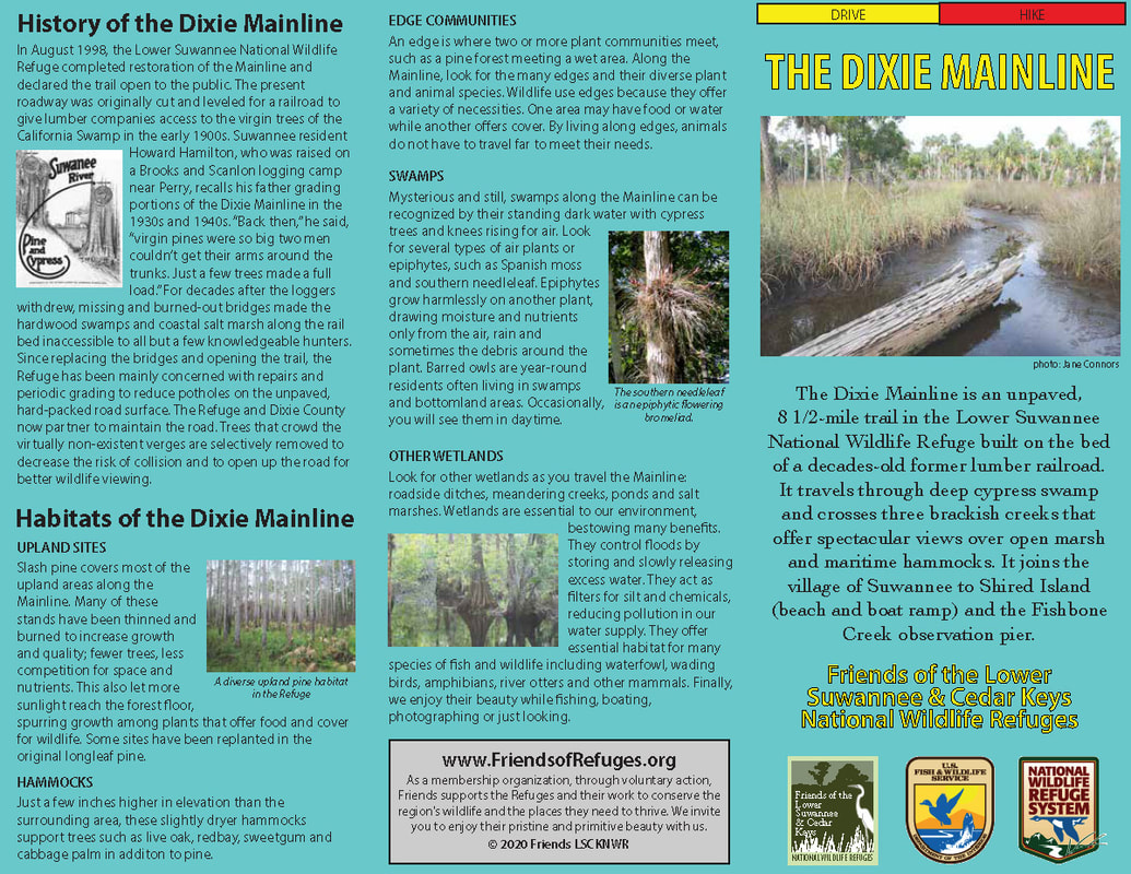
The Dixie Mainline is an unpaved, 8 1/2-mile trail in the Lower Suwannee National Wildlife Refuge built on the bed of a decades-old former lumber railroad. It travels through deep cypress swamp and crosses three brackish creeks that offer spectacular views over open marsh and maritime hammocks. It joins the village of Suwannee to Shired Island (beach and boat ramp) and the Fishbone Creek observation pier.
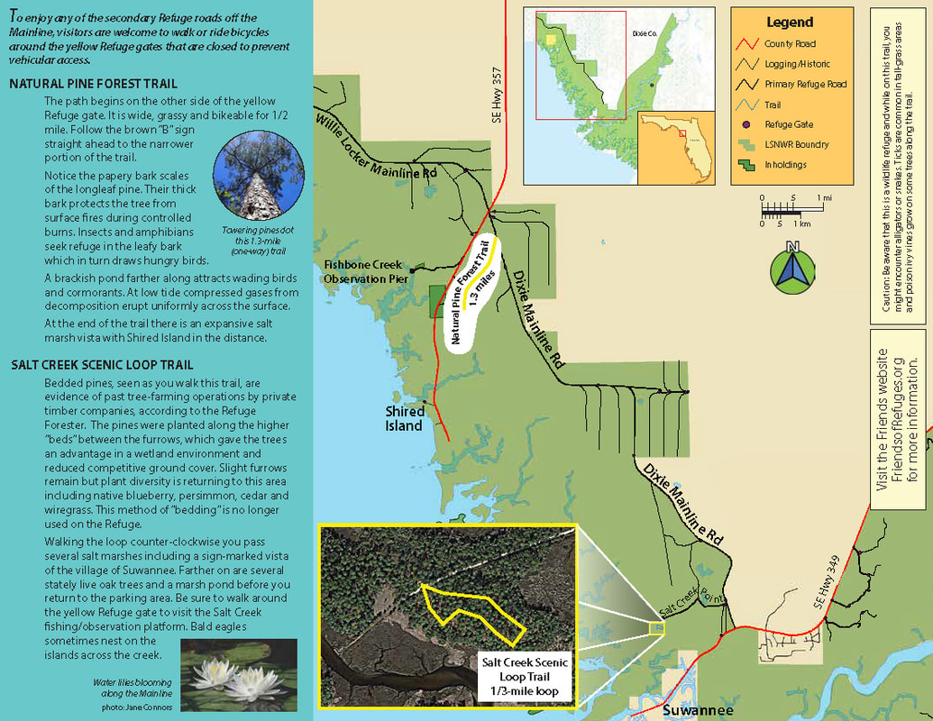
To enjoy any of the secondary Refuge roads o the Mainline, visitors are welcome to walk or ride bicycles around the yellow Refuge gates that are closed to prevent vehicular access.
To enjoy any of the secondary Refuge roads o the Mainline, visitors are welcome to walk or ride bicycles around the yellow Refuge gates that are closed to prevent vehicular access.
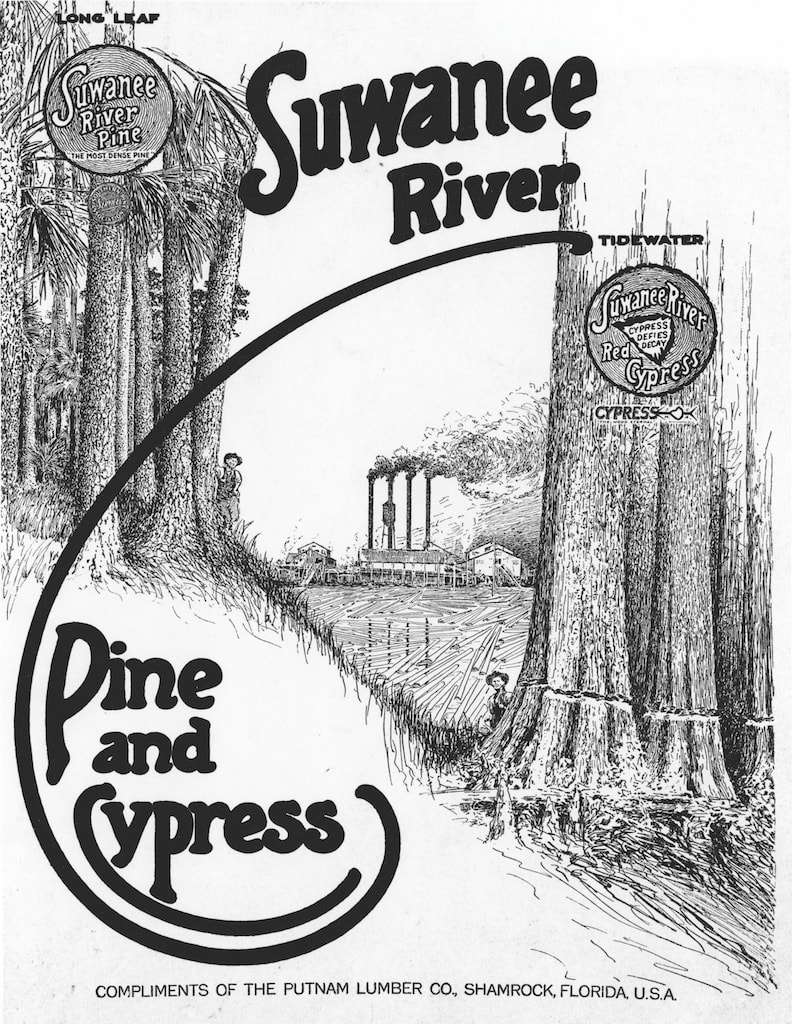
History of the Dixie Mainline
|
In August 1998, the Lower Suwannee National Wildlife Refuge completed restoration of the Mainline and declared the trail open to the public. The present roadway was originally cut and leveled for a railroad to
give lumber companies access to the virgin trees of the California Swamp in the early 1900s. Suwannee resident Howard Hamilton, who was raised on a Brooks and Scanlon logging camp near Perry, recalls his father grading portions of the Dixie Mainline in the 1930s and 1940s. “Back then,” he said, “virgin pines were so big two men couldn’t get their arms around the trunks. Just a few trees made a full load.” For decades after the loggers withdrew, missing and burned-out bridges made the hardwood swamps and coastal salt marsh along the rail bed inaccessible to all but a few knowledgeable hunters. Since replacing the bridges and opening the trail, the Refuge has been mainly concerned with repairs and periodic grading to reduce potholes on the unpaved, hard-packed road surface. The Refuge and Dixie County now partner to maintain the road. Trees that crowd the virtually non-existent verges are selectively removed to decrease the risk of collision and to open up the road for better wildlife viewing. |
|
Habitats of the Dixie Mainline
|
UPLAND SITES
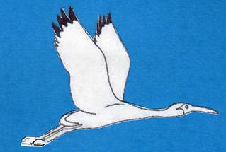
Slash pine covers most of the upland areas along the Mainline. Many of these stands have been thinned and burned to increase growth and quality; fewer trees, less competition for space and nutrients. This also let more sunlight reach the forest floor, spurring growth among plants that offer food and cover for wildlife. Some sites have been replanted in the original longleaf pine. HAMMOCKS Just a few inches higher in elevation than the surrounding area, these slightly dryer hammocks support trees such as live oak, redbay, sweetgum and cabbage palm in addition to pine. EDGE COMMUNITIES An edge is where two or more plant communities meet, such as a pine forest meeting a wet area. Along the Mainline, look for the many edges and their diverse plant and animal species. Wildlife use edges because they offer a variety of necessities. One area may have food or water while another offers cover. By living along edges, animals do not have to travel far to meet their needs. SWAMPS Mysterious and still, swamps along the Mainline can be recognized by their standing dark water with cypress trees and knees rising for air. Look for several types of air plants or epiphytes, such as Spanish moss and southern needleleaf. Epiphytes grow harmlessly on another plant, drawing moisture and nutrients only from the air, rain and sometimes the debris around the plant. Barred owls are year-round residents often living in swamps and bottomland areas. Occasionally, you will see them in daytime. OTHER WETLANDS Look for other wetlands as you travel the Mainline: roadside ditches, meandering creeks, ponds and salt marshes. Wetlands are essential to our environment, bestowing many benefits. They control floods by storing and slowly releasing excess water. They act as filters for silt and chemicals, reducing pollution in our water supply. They offer essential habitat for many species of sh and wildlife including waterfowl, wading birds, amphibians, river otters and other mammals. Finally, we enjoy their beauty while fishing, boating, photographing or just looking. |
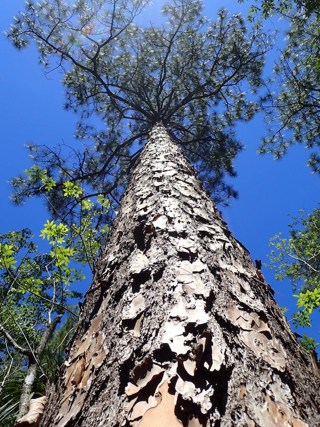
A towering pine on the Tall Pines Trail

Waterlilies line the scenic Dixie Mainline
|
Tall Pines Trail
The path begins on the other side of the yellow Refuge gate. It is wide, grassy and bike-able for 1/2 mile. Follow the brown “B” sign straight ahead to the narrower portion of the trail.
Notice the papery bark scales of the longleaf pine. Their thick bark protects the tree from surface res during controlled burns. Insects and amphibians seek refuge in the leafy bark which in turn draws hungry birds.
A brackish pond farther along attracts wading birds and cormorants. At low tide compressed gases from decomposition erupt uniformly across the surface. At the end of the trail there is an expansive salt marsh vista with Shired Island in the distance.
Salt Creek Scenic Loop Trail
Bedded pines, seen as you walk this trail, are evidence of past tree-farming operations by private timber companies, according to the Refuge Forester. The pines were planted along the higher “beds” between the furrows, which gave the trees an advantage in a wetland environment and reduced competitive ground cover. Slight furrows remain but plant diversity is returning to this area including native blueberry, persimmon, cedar and wiregrass. This method of “bedding” is no longer used on the Refuge.
Walking the loop counter-clockwise you pass several salt marshes including a sign-marked vista of the village of Suwannee. Farther on are several stately live oak trees and a marsh pond before you return to the parking area. Be sure to walk around the yellow Refuge gate to visit the Salt Creek fishing/observation platform. Bald eagles sometimes nest on the islands across the creek.
Walking the loop counter-clockwise you pass several salt marshes including a sign-marked vista of the village of Suwannee. Farther on are several stately live oak trees and a marsh pond before you return to the parking area. Be sure to walk around the yellow Refuge gate to visit the Salt Creek fishing/observation platform. Bald eagles sometimes nest on the islands across the creek.
Friends of the Lower Suwannee & Cedar Keys National Wildlife Refuges
P. O. Box 532 Cedar Key, FL 32625 [email protected] We are a 501(c)(3) nonprofit organization. |
|