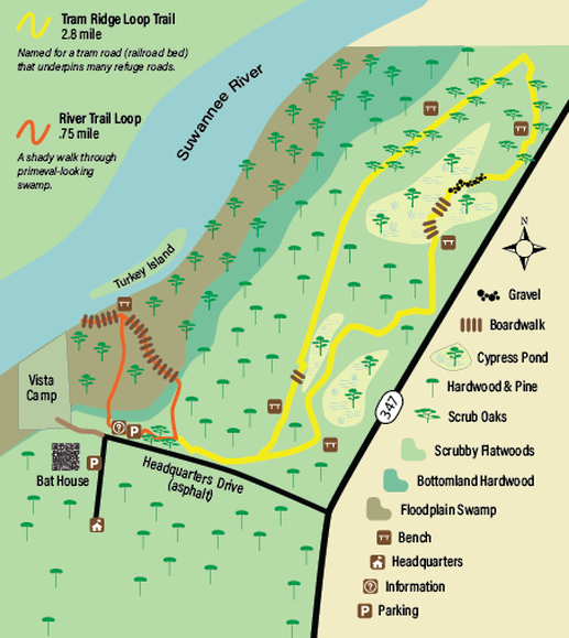
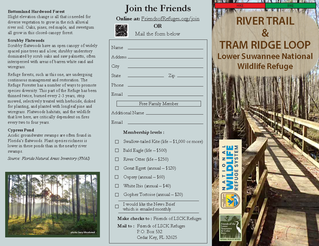
THE RIVER TRAIL LOOP (0.3 mile spur to the river, 0.7 mile loop)
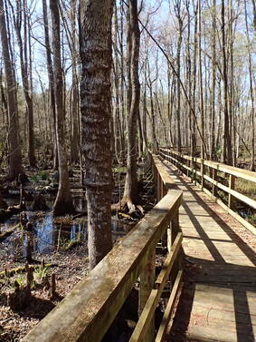
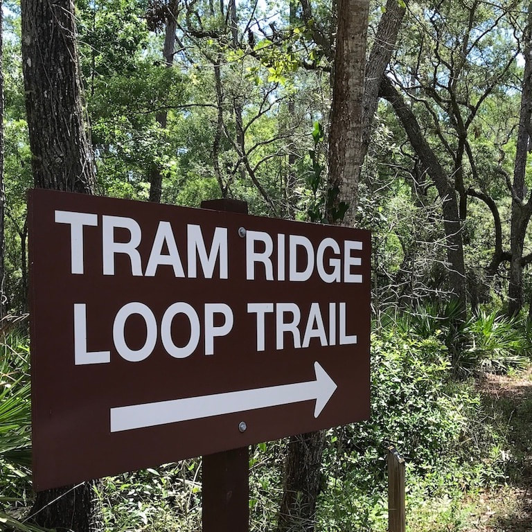
THE TRAM RIDGE LOOP TRAIL (2.8 mile loop)
|
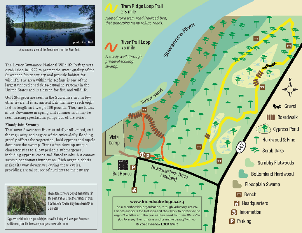
The Lower Suwannee National Wildlife Refuge was established in 1979 to protect the water quality of the Suwannee River estuary and provide habitat for wildlife. The area within the Refuge is one of the largest undeveloped delta-estuarine systems in the United States and is a haven for fish and wildlife. Gulf Sturgeon are seen in the Suwannee and in few other rivers. It is an ancient fish that may reach eight feet in length and weigh 200 pounds. They are found in the Suwannee in spring and summer and may be seen making spectacular jumps out of the water.
Floodplain Swamp The lower Suwannee River is tidally influenced, and the regularity and degree of the twice-daily flooding greatly affects the vegetation; bald cypress and tupelo dominate the swamp. Trees often develop unique characteristics to allow periodic submergence, including cypress knees and fluted trunks, but cannot survive continuous inundation. Rich organic debris makes its way downriver during these cycles, providing a vital source of nutrients to the estuary. Bottomland Hardwood Forest Slight elevation change is all that is needed for diverse vegetation to grow in the rich alluvial river soil. Oaks, pines, red maple, and sweetgum all grow in this closed-canopy forest. Scrubby Flatwoods Scrubby flatwoods have an open canopy of widely spaced pine trees and a low, shrubby understory dominated by scrub oaks and saw palmetto, often interspersed with areas of barren white sand and wiregrass. Refuge forests, such as this one, are undergoing continuous management and restoration. The Refuge Forester has a number of ways to promote species diversity. This part of the Refuge has been thinned twice, burned every 2-3 years, strip mowed, selectively treated with herbicide, disked for planting, and planted with longleaf pine and wiregrass. Flatwoods habitats, and the wildlife that live here, are critically dependent on fires every two to four years. Cypress Pond Acidic groundwater swamps are often found in Florida’s flatwoods. Plant species richness is lower in these ponds than in the nearby river swamps. Source: Florida Natural Areas Inventory (FNAI) |
Boardwalk leading to the Suwannee River.
Scrub oaks along the Tram Ridge trail.
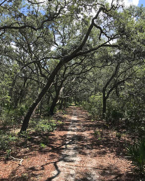
Suwannee River
|
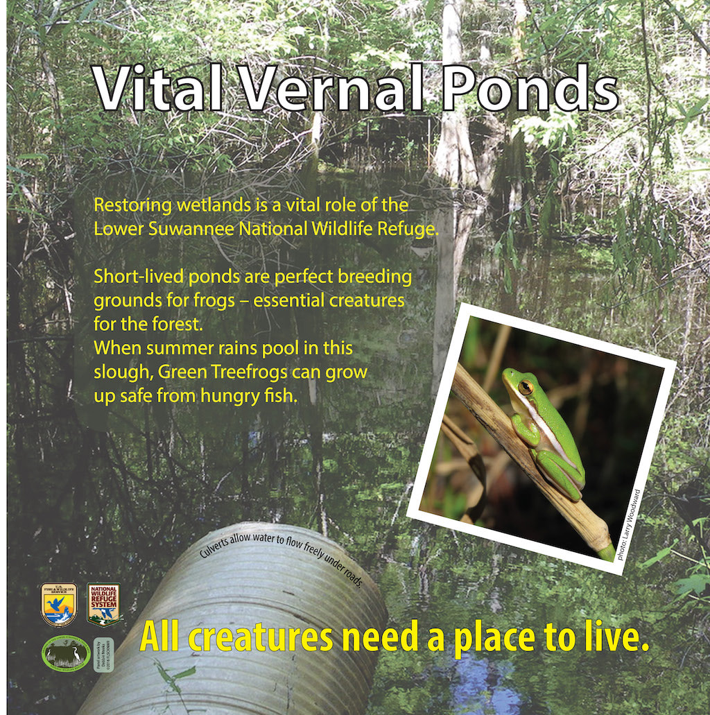
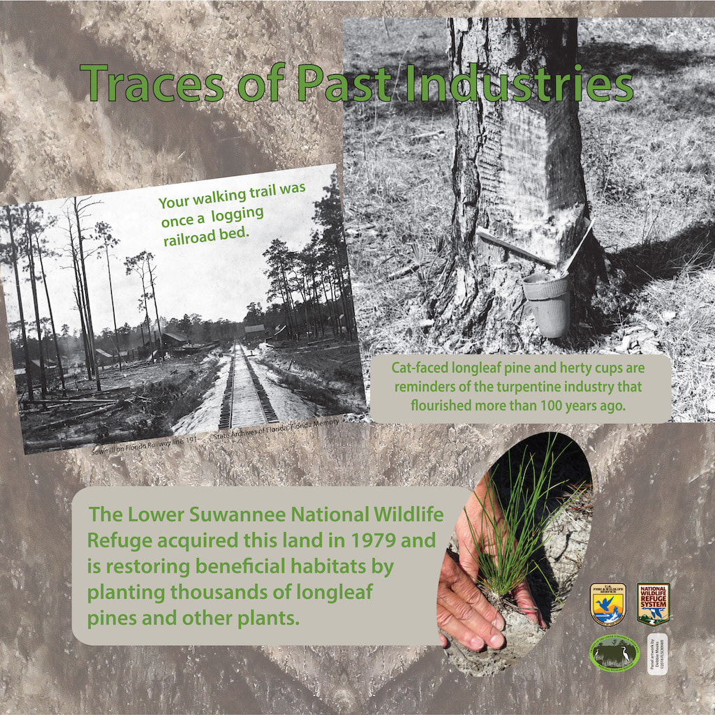
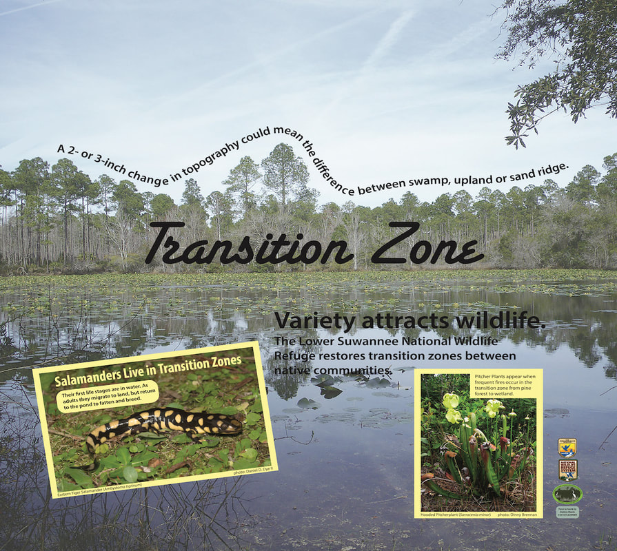
SIGNS ALONG THE TRAM RIDGE LOOP TRAIL
THE RIVER TRAIL AND TRAM RIDGE LOOP BROCHURE
Friends of the Lower Suwannee & Cedar Keys National Wildlife Refuges
P. O. Box 532 Cedar Key, FL 32625 [email protected] We are a 501(c)(3) nonprofit organization. |
|