|
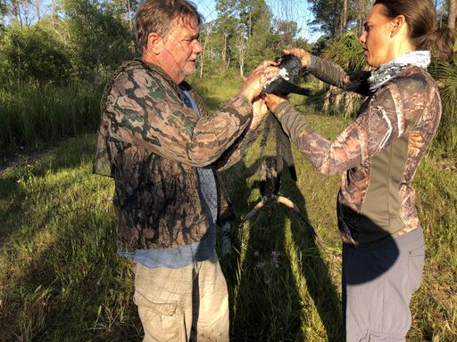
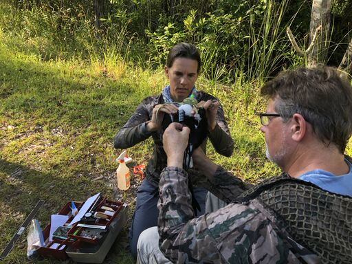
As mentioned in the post below, Friends of the Lower Suwannee & Cedar Keys NWRs provided support to tag Suwannee, a Swallow-tailed Kite that is now migrating from the Refuge to his wintering area in Brazil. Stories about the research and tracking of the migrating birds have recently been published by Audubon and bioGraphic. Each site has an interactive map that allows you to follow Suwannee's migration. The map will be updated weekly. Enjoy!
0 Comments
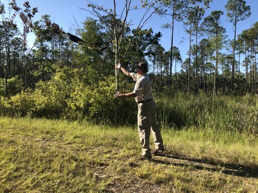
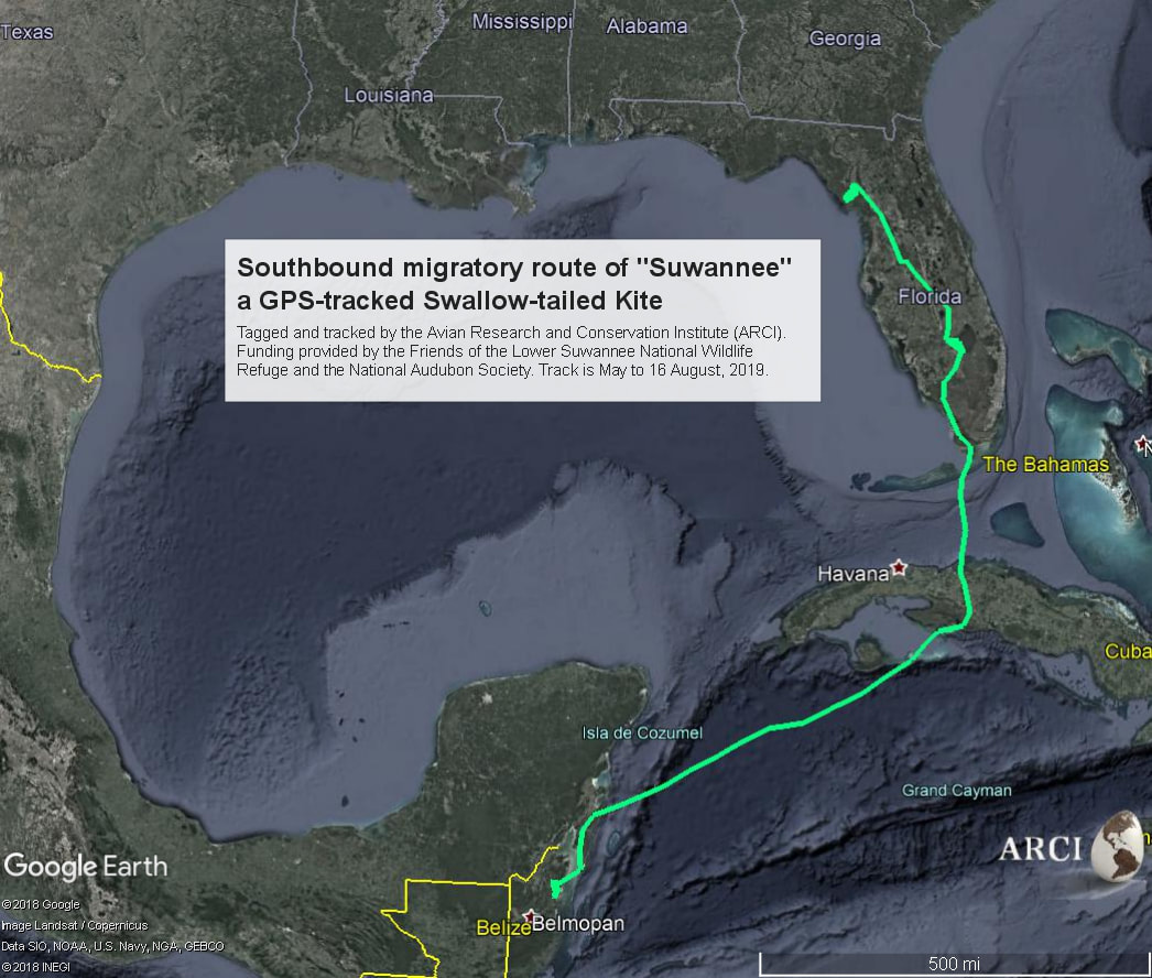 Suwannee left the Refuge in early August to begin his migration. He is now in the Yucatan. Debbie Jordan, here. I am a member of the Friends Board of Directors. I am shepherding Friends' Swallow-tailed Kite Project. In the spring of this year, Friends provided funding to tag one Swallow-tailed Kite that was summering on the Refuge so it could be tracked during its migration to Brazil and back. Here is the background. Now, I have an update.
Stay tuned to the website for updates on his progress, as he makes his way to South America! We wish Suwannee and the other 15 birds of the Class of 2019 a safe migration with plenty to eat. Habitat loss along the flyways is a huge threat for migrating birds. Articles about kite research are anticipated this fall in the Audubon magazine and other publications. We will keep you posted as more info becomes available.
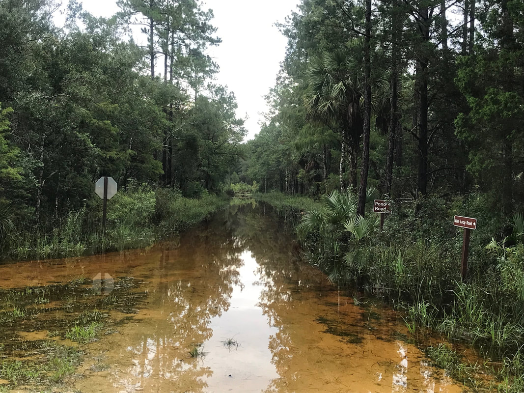
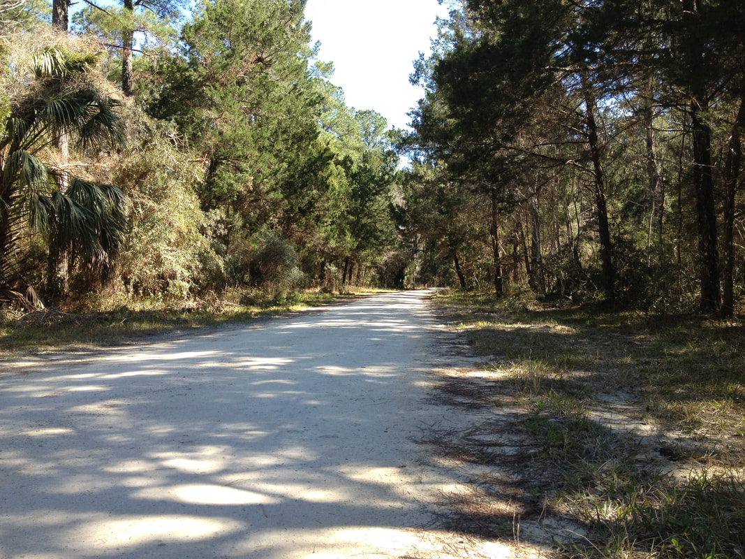
This graphic, from Refuge biologist Vic Doig, shows the hourly and accumulated precipitation at the Lower Suwannee Refuge over the past week, from August 12 to August 20. 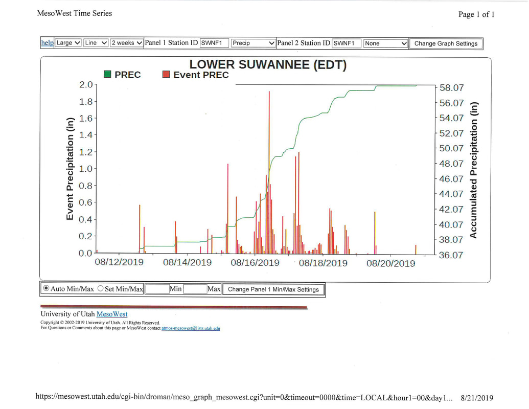 Note from the webmaster: The comment below makes us want to clarify the post. The video is a time-lapse. It is 33 seconds long and was taken as the Deputy Refuge Manager drove a little over a mile of the road at about 3 miles per hour to assess the flooding. The video looks like the driver is zooming, which as the comments says, would severely damage the road surface. The flowing water, all by itself, caused erosion and damage to the road, which will be repaired when the flooding abates. Refuge Manager,Andrew Gude, provides his cell phone number at the upper right on our home page. You can call him for an update on the roads if you are thinking of heading to the Refuge. As of Monday August 26, none of the Refuge roads are open. Here is the original post: Don't try this at home. Driving on flooded roads, especially the limerock Refuge roads, is never wise. Even if you don't get stuck, ruts you cause in the soft roadbed have to be repaired. Refuge Asst. Manager Larry Woodward took this video when he assessed the extent of the flooded Nature Drive, giving us a rare look as if we were driving with him through the flooded Refuge.
Roads on the Refuge, on the Levy County side, are still closed as of August 22 due to flooding. County Road 347, from which one accesses the Refuge roads, was closed for several days. It reopened on Wednesday August 21.
Refuge staff members are monitoring the roads and other areas. Refuge Biologist, Vic Doig, reports that "The Refuge area received over 20" of rain between Aug 14 - Aug 18th, and much of the area is heavily flooded. The last time we saw nearly as much rain in a short period was during Hurricanes Francis and Jean in Sept 2004, when about 15" fell over a few days. All Refuge roads are currently closed, and even some adjacent highways are partially closed due to flooding. For comparison sake, our average annual rainfall is about 50" a year - we are already well above that with this recent event, and it is still August!! Let's all hope and pray for a dry hurricane season this year." When Refuge Manager Andrew Gude checked on the Nature Drive yesterday, he reported that "In a brief period of time I saw, in the same view, a gator laying in the road, a snake moving across it, gar swimming like salmon over the road, and an egret standing on the downside of the road nailing fish as they came over the road."
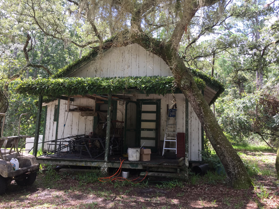
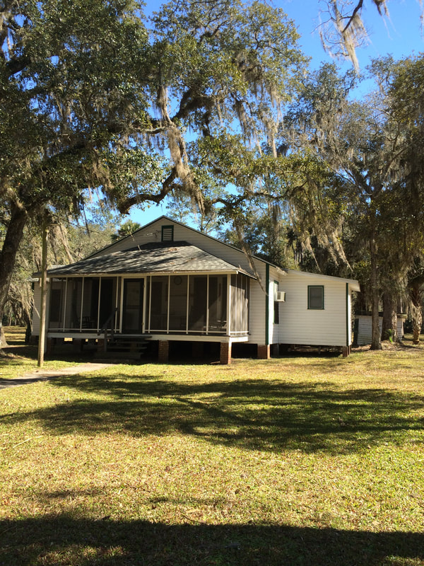
Friends of the Lower Suwannee and Cedar Keys National Wildlife Refuges is requesting proposals from duly licensed and qualified consultants or consulting teams to perform an assessment of several historic structures on the Vista site within the Lower Suwannee Refuge near Fowler’s Bluff, Florida. We are interested in using the Vista site for visitor contact and interpretation.
We have received a planning grant from the Florida Department of State Division of Historical Resources to conduct for the project. This project will provide documentation and information about the buildings at Vista, and hopefully, will be a planning tool for the maintenance, stabilization, preservation, and future rehabilitation of the structures. The full RFP is available here. New information indicates that Snake Key, in addition to all the other birds now roosting there, is a significant pre-migratory mass roosting site for Purple Martins. Folks in Cedar Key started seeing and reporting massive numbers of purple martins a couple years ago in the mid to late summer. The Refuge staff members worked with Dr. Jason Fletcher, a Disney Animal Kingdom researcher who tagged some of the birds. One was tracked to Snake Key after last breeding season. Further investigation by Dr. Fisher and Refuge biologist Vic Doig show that as many as 5,000 Purple Martins were roosting overnight at Snake Key in July.
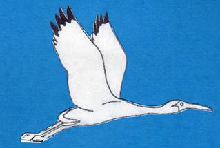
 Photo by Friends member Ann Kamzelski The Friends of the Lower Suwannee & Cedar Keys NWRs is helping support the satellite tracking of a Swallow-tailed Kite as it migrates from the Refuge to Brazil.
Read more at Swallow-tailed Kite Migration: a ten thousand mile odyssey
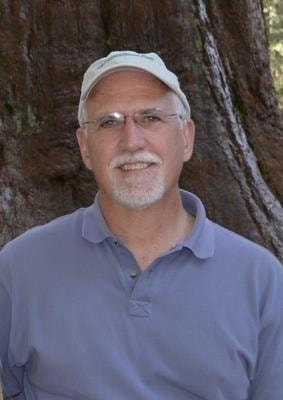
George talked us through his expansive, inspiring vision of the Big Bend Conservation effort, with detailed data on its history and current status, on key land areas for needed conservation, on key players, and on the role that the Lower Suwannee and other Refuges could play in the effort to keep the Big Bend as a driver for the regional economy and quality of life.
George was a man who made a difference in all our lives, even those of us who never were lucky enough to meet him personally. Clay Henderson, a lawyer and professor at Stetson University, was quoted in Politico as saying that only Teddy Roosevelt conserved more land in Florida than George did. He was involved in about half a million acres of land deals. George's obituary can be found here. |

Friends of the Lower Suwannee & Cedar Keys National Wildlife Refuges
P. O. Box 532 Cedar Key, FL 32625 [email protected] We are a 501(c)(3) nonprofit organization. |
|