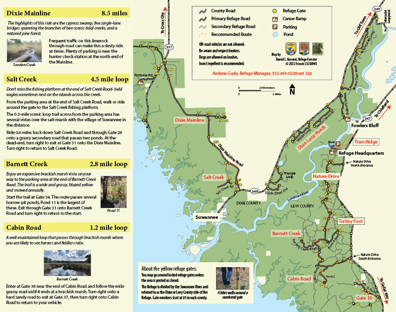
Our Refuge has nearly 200 miles of former logging roads. Many make scenic bike rides suitable for any fat-tire bicycle.
Hiking these routes is also a good option.
Dixie Mainline- 8.5 milesThe highlights of this ride are the cypress swamp, five single-lane bridges spanning the branches of two scenic tidal creeks, and a restored pine forest.
Traffic, though infrequent, on this limerock through-road can make it a dusty ride at times. Plenty of parking is near the hunter check-station at the north end of the Mainline.
Salt Creek- 4.5 mile loopDon’t miss the fishing platform at the end of Salt Creek Road- bald eagles sometimes nest on the islands across the creek.
From the parking area at the end of Salt Creek Road, walk or ride around the gate to the Salt Creek fishing platform. The 0.3-mile scenic loop trail across from the parking area has several vistas over the salt-marsh with the village of Suwannee in the distance. Ride 0.6 miles back down Salt Creek Road and through Gate 28 onto a grassy secondary road that passes two ponds. At the dead-end, turn right to exit at Gate 31 onto the Dixie Mainline. Turn right to return to Salt Creek Road. |
|
Barnett Creek- 2.8 mile loop
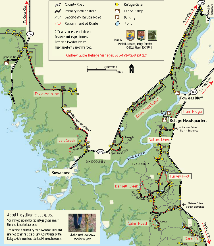
Enjoy an expansive brackish marsh vista on your way to the parking area at the end of Barnett Creek Road. The trail is a wide and grassy, blazed yellow and mowed annually.
Start the trail at Gate 34. The route passes several borrow-pit ponds, Pond 11 is the largest of these. Exit through Gate 31 onto Barnett Creek Road and turn right to return to the start.
Start the trail at Gate 34. The route passes several borrow-pit ponds, Pond 11 is the largest of these. Exit through Gate 31 onto Barnett Creek Road and turn right to return to the start.
- More information is found in the Barnett Creek Hiking Guide including frequently seen wildlife descriptions.
Cabin Road- 1.2 mile loop
|
A well-maintained loop that passes through brackish marsh where you are likely to see herons and fiddler crabs.
Enter at Gate 38 near the end of Cabin Road and follow the wide grassy road until it ends at a brackish marsh. Turn right onto a hard sandy road to exit at Gate 37, then turn right onto Cabin Road to return to your vehicle. |
Barnett Creek
|
Gate 10 Road- 1.5 miles
One of the least trafficked primary roads on the Levy County side of the Refuge, it is an easy and scenic ride.
Park near the beginning of Gate 10 Road. This live oak-canopied, hard-packed road ends at two large ponds. The secondary road beyond Gate 50 is impassable.
Park near the beginning of Gate 10 Road. This live oak-canopied, hard-packed road ends at two large ponds. The secondary road beyond Gate 50 is impassable.
Turkey Foot- 2.5 mile loop
|
This trail gets its name from three gates at the end of Pond 4 Road that form a ‘turkey foot.’ Wide and grassy, the trail is blazed yellow.
Start the trail at Gate 28. At the first fork look for long-leaf pines and wiregrass that were planted when the area was restored to native habitat in 2013. Turn right to Pond 5—one of many borrow pits dug prior to Refuge management when timber companies needed material to build roads. Turkey Foot is a good area to spot birds, butterflies and wildflowers. Swallow-tailed kites are frequently seen during their spring breeding season.
|
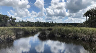
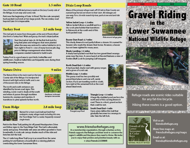
Ride around refuge gates
|
Nature Drive- 9 miles
The Nature Drive is the main road on the Levy County side of the Refuge. It is hardpacked limerock with light vehicle traffic and is one of the easiest rides in the Refuge.
The north and south entrances are identified by brown road signs. This winding, scenic road is shady at the south end where it passes through maritime hammocks, swamps and marshes. It transitions to pine uplands farther north.
The north and south entrances are identified by brown road signs. This winding, scenic road is shady at the south end where it passes through maritime hammocks, swamps and marshes. It transitions to pine uplands farther north.
- More information is found in the Nature Drive Guide.
Tram Ridge- 2.8 mile loop
Named for a tram road (railroad bed) that underpins many refuge roads including this one, the Tram Ridge Trail is a wide, frequently-mowed single-track.
Park in the River Trail parking lot o paved Headquarters Drive and follow signs to the Tram Ridge Trail. The trail is alternately sandy and grassy. Potentially wet areas are either graveled or have boardwalks. A scrub oak canopy shades much of the ride and benches dot the trail.
The 0.7-mile long River Trail Loop is accessed from the same parking lot and features a boardwalk to a viewing platform overlooking the lower Suwannee River.
- More information is found in the Tram Ridge Hiking Trail Guide.
Dixie Loop Roads
|
Many of the primary refuge roads off CR 349 in Dixie County are named loop but do not return to their start. All mileages are one-way. For a 30-mile round-trip tour, park at one end and ride them all.
|
Triangle Loop Pond
|
Yellow Jacket Loop–1.3 miles
Yellow Jacket follows a sandhill and is a dry scrub pine habitat that transitions to flatwoods at the south end of this hard-packed road.
Beaver Dam Road–2.7 miles
This shady, limerock road partly follows a stream. It is named for beavers who made the stream their home. However, a beaver has not been sighted for many years.
Weeks Landing–1.5 miles
A shady hard-packed road that has two gravel-lined swampy areas near the river. A canoe launch at the end features a view of Fowlers Bluff. Look for jumping Gulf sturgeon.
North Dead End–1.5 miles
A hard-packed, shady road with grassy verges and a grove of scrub oak.
Middle Loop–1.5 miles
This grassy road has two possibly wet gravel-lined places and one soft, sandy section. If you are traveling north to south, turn right at the unnamed fork as the road ahead dead-ends.
Triangle Loop–1.5 miles
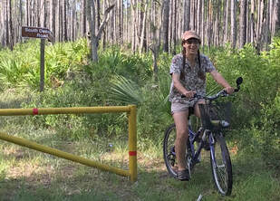
A large lily-studded pond anchors the north end of this curving limerock road. There is a short, gravel section that could be wet.
South Dead End–1 mile
Open pines define this trail that gradually becomes too swampy to ride. Take the left fork.
Yellow Jacket follows a sandhill and is a dry scrub pine habitat that transitions to flatwoods at the south end of this hard-packed road.
Beaver Dam Road–2.7 miles
This shady, limerock road partly follows a stream. It is named for beavers who made the stream their home. However, a beaver has not been sighted for many years.
Weeks Landing–1.5 miles
A shady hard-packed road that has two gravel-lined swampy areas near the river. A canoe launch at the end features a view of Fowlers Bluff. Look for jumping Gulf sturgeon.
North Dead End–1.5 miles
A hard-packed, shady road with grassy verges and a grove of scrub oak.
Middle Loop–1.5 miles
This grassy road has two possibly wet gravel-lined places and one soft, sandy section. If you are traveling north to south, turn right at the unnamed fork as the road ahead dead-ends.
Triangle Loop–1.5 miles
A large lily-studded pond anchors the north end of this curving limerock road. There is a short, gravel section that could be wet.
South Dead End–1 mile
Open pines define this trail that gradually becomes too swampy to ride. Take the left fork.
|
|
Friends of the Lower Suwannee & Cedar Keys National Wildlife Refuges
P. O. Box 532 Cedar Key, FL 32625 [email protected] We are a 501(c)(3) nonprofit organization. |
|